What is Vtol Lidar Drone and How Can It Benefit Your Business?
In an increasingly competitive landscape, businesses are continually seeking innovative technologies to enhance their operations. The advent of the "Vtol Lidar Drone" has sparked significant interest among industry leaders for its unique capabilities. James Anderson, a renowned expert in aerial robotics, states, "Vtol Lidar Drones have the potential to revolutionize data collection processes." This sentiment underscores the growing recognition of their efficiency and precision in mapping and surveying.
These drones combine vertical take-off and landing (VTOL) capabilities with advanced lidar (Light Detection and Ranging) technology. This fusion allows for detailed topographic surveys and real-time data processing. With the ability to capture high-resolution images and topographic data, Vtol Lidar Drones offer businesses the means to make informed decisions faster. However, the technology is still evolving, needing refinement in reliability and cost-effectiveness.
As evident in its early implementations, the use of Vtol Lidar Drones requires careful consideration. Companies must assess their specific needs before investing. While some might experience remarkable benefits, others may find the initial integration challenging. As this technology matures, the future seems promising, with room for improvement and innovation ahead.
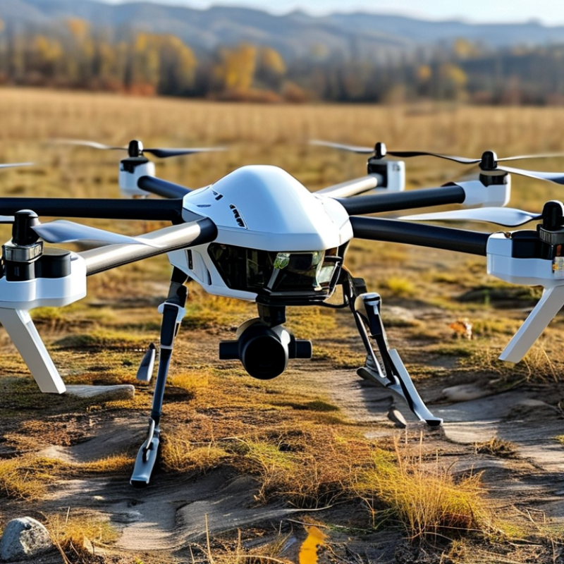
What is a VTOL Lidar Drone? Overview and Technological Features
VTOL Lidar drones represent a significant advancement in aerial surveying technology. These drones combine Vertical Take-Off and Landing (VTOL) capabilities with Lidar sensors, enabling them to navigate complex environments with precision. Typically, they can take off and land in small spaces, a feature that allows for greater operational flexibility. The technology behind Lidar uses laser pulses to measure distances and create high-resolution 3D maps of the terrain below. This is particularly valuable for industries such as architecture, construction, and environmental monitoring.
Incorporating VTOL Lidar drones can enhance data collection efforts dramatically. Businesses can gather accurate topographical and structural data faster than traditional methods allow. This efficiency can lead to significant cost savings and improved project timelines. These drones are also equipped with advanced sensors that can operate effectively in varying weather conditions. However, the technology requires experienced operators to maximize its potential. Training and proper understanding of the drone’s capabilities are essential for ensuring effective use.
Despite their advantages, there are challenges. For instance, the initial costs of acquiring and maintaining VTOL Lidar drones can be high. Companies must consider the return on investment carefully. There may be a learning curve for staff that needs to be addressed. Balancing the benefits against these challenges is crucial for businesses looking to integrate this innovative technology into their operations.
Key Applications of VTOL Lidar Drones in Various Industries
VTOL (Vertical Take-Off and Landing) Lidar drones are transforming industries. These drones combine the capabilities of traditional UAVs with advanced Lidar technology, allowing for precise mapping and surveying. According to the latest market research, the global Lidar market is projected to reach $3.7 billion by 2026, highlighting a growing demand for this technology in various sectors.
In construction, for instance, VTOL Lidar drones provide accurate topographical data for site planning. They can capture high-resolution images and 3D models within hours, significantly reducing project timelines. A study by the Construction Industry Institute indicates that using drones can increase productivity by up to 35%. This technology aids in maintaining safety standards while optimizing resource allocation.
In agriculture, these drones facilitate precision farming. They can assess crop health, monitor irrigation patterns, and even identify pest infestations early. A report from the Food and Agriculture Organization shows that adopting advanced technologies like Lidar can improve crop yields by 20% or more. However, integrating these systems is not without challenges. Data management and interpretation require expertise, which can limit accessibility for some farmers.
Analyzing Cost Efficiency: VTOL Lidar Drones vs. Traditional Survey Methods
VTOL LiDAR drones are revolutionizing the survey industry. Their advanced technology reduces the time and cost compared to traditional survey methods. A recent report by ResearchAndMarkets suggests that LiDAR technology can increase productivity by up to 50%. This efficiency is crucial for businesses looking to maximize resources.
Traditional surveying methods often involve extensive manpower and equipment. They rely heavily on ground-based data collection, which can be slow and prone to errors. With VTOL LiDAR drones, aerial surveys can cover large areas quickly, minimizing human labor and time. According to a study by Deloitte, using drones can cut survey costs by 30% to 40%, making them an attractive option for many businesses.
For companies considering this technology, it's important to keep in mind the need for proper training. Using these drones responsibly ensures data integrity and safety. Regular maintenance of the drones can optimize performance and longevity, adding value to your investment. Embracing this innovation may require initial investment, but the long-term savings can be substantial.
Enhancing Data Accuracy and Collection Speed with VTOL Lidar Technology
VTOL lidar drones are changing how businesses collect data. They combine vertical takeoff and landing capabilities with advanced lidar technology. This allows for efficient surveying of large areas in less time, reducing project timelines. With these drones, data accuracy improves significantly, making it easier to analyze topographic features.
Integrating VTOL lidar technology can elevate mapping and inspection tasks. Traditional methods often involve extensive ground work, which is time-consuming. In contrast, lidar-equipped drones capture high-resolution images and 3D models swiftly. These models offer detailed insights, which can enhance decision-making processes.
When deploying VTOL lidar drones, consider your specific needs. Start with small test flights to gauge performance. Analyze the data collected and adjust your approach accordingly. Also, ensure your team receives proper training on the technology. Familiarity with the equipment can help avoid common pitfalls. Embrace the learning process for optimal performance and results.
What is VTOL Lidar Drone and How Can It Benefit Your Business?
| Feature | Description | Benefit |
| VTOL Capability | Vertical Takeoff and Landing technology | Allows operation in confined spaces without needing runways |
| Lidar Technology | Laser-based sensor for precise distance measurement | Enhances data accuracy in mapping and surveying |
| Speed of Data Collection | Fast scanning speeds with real-time data processing | Reduces project timelines and increases efficiency |
| Automation | Automated flight paths and data capture | Minimizes human errors and operational costs |
| Versatility | Suitable for various industries, including construction, forestry, and agriculture | Broadens application potential and market reach |
Future Trends: The Growing Role of VTOL Lidar Drones in Business Operations
The landscape of business operations is rapidly changing with the advent of VTOL (Vertical Take-Off and Landing) Lidar drones. These innovative machines combine the precision of Lidar technology with the versatility of vertical flight capabilities. The growing role of VTOL Lidar drones can enhance data collection, enabling companies to conduct surveys and inspections more efficiently. This is crucial in sectors like agriculture, construction, and infrastructure monitoring.
As industries grapple with complex data requirements, VTOL Lidar drones provide a solution. They can cover large areas quickly, saving both time and resources. Their ability to access challenging terrains is a game changer. However, the integration of this technology into existing workflows is not always smooth. Companies often face challenges in training staff or managing data outputs effectively. Businesses must reflect on their readiness for such a significant transition.
Looking ahead, the demand for VTOL Lidar drones is expected to rise. Their potential seems limitless, yet there’s a risk of over-reliance on the technology. Entrepreneurs need to balance drone usage with human insight. Embracing these tools can lead to more informed decisions, but companies should remain cautious about potential pitfalls. Continuously evaluating the effectiveness of drone-driven insights will ensure lasting benefits.